SIGMA-GEO offers 4D TEM surveys, which allow mapping the movement of the waterflooding of the deposit front in time.
The relevance
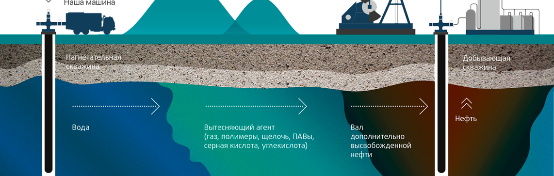
More than 70% of oil deposits are exploited while maintaining reservoir pressure through waterflooding. Control and regulation of the flood front is one of the main principles of rational deposit development.
Solutions
The ratio of oil-saturated and water-saturated thicknesses affects the level of resistivity of the productive interval. Carrying out repeated measurements after a certain period of time with a complete reproduction of the initial layout of 3D TEM stations makes it possible to record changes in resistivity associated with the advancement of the water expansion front.
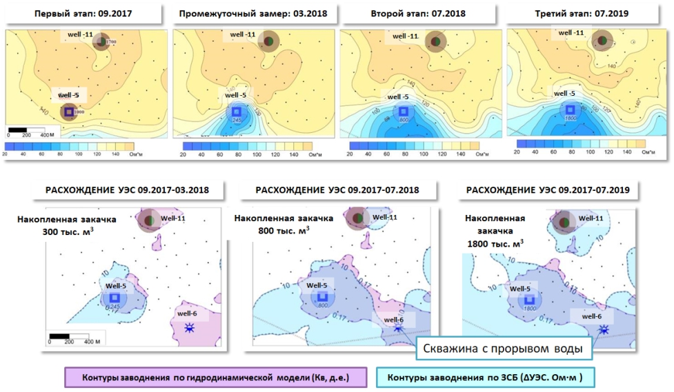
The case study: Comparison of the results of 4D TEM survey with the hydrodynamic model
(upper row - resistivity maps based on the results of 3D TEM surveys carried out in September 2017, March 2018, July 2018 and July 2019;
bottom row - dynamics of flooding pattern according to the TEM data and hydrodynamic model)
The effect of using 4D TEM surveys
- Possibility of prorationing control.
- Optimization of the development system and plan for transferring wells to maintain reservoir pressure.
- Identification of zone of secondary alterations.
- Monitoring the effectiveness of the maintain reservoir pressure system..
- Geometrization of interwell space.
SIGMA-GEO experience
- The employees' work experience in this area exceeds 8 years.
Geography of work